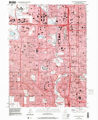
1999 Map of Salt Lake City South
USGS Topo · Published 2001About this map
The Jordan River corridor serves as the central spine for this 1990s urban landscape, illustrating the intensive post-war expansion south of Salt Lake City. This period captures the transition of formerly agricultural areas like Granger and Bennion into a dense grid of suburban infrastructure. The map records a significant moment in local history with the presence of the E Center (2002 Olympics Site), marking preparations for the upcoming Winter Games.
Find a feature on this map
127 named features on this map. Tap any name to fly to it.
Don’t see what you’re looking for? This feature index may not catch every label — zoom into the map to look around manually.
Map Details
Editions of this 1999 Salt Lake City South Map
This is the sole edition of this map. No revisions or reprints were ever made.
Other maps of this area

1885 · Salt Lake
USGS Topo · 1:250,000

1885 · Tooele Valley
USGS Topo · 1:250,000

1925 · Ft. Douglas
USGS Topo · 1:125,000

1928 · Ft. Douglas
USGS Topo · 1:125,000

1950 · Fort Douglas
USGS Topo · 1:24,000

1951 · Fort Douglas
USGS Topo · 1:24,000

1951 · Saltair
USGS Topo · 1:24,000

1951 · Salt Lake City South
USGS Topo · 1:24,000

1951 · Midvale
USGS Topo · 1:24,000

1951 · Salt Lake City North
USGS Topo · 1:24,000