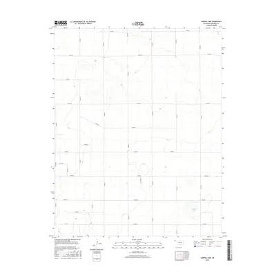
2016 Map of Sampsel Lake
USGS Topo · Published 2016About this map
Sampsel Lake and the surrounding high plains of Cimarron County define this 2016 study of the Oklahoma Panhandle. The landscape is characterized by a precise, geometric grid of rural section roads, including E0180 Rd and N0410 Rd, which facilitate transport across this dry plateau. These routes reflect the long-standing township and range system that organized the region's agricultural development. The terrain is marked by subtle depressions and ephemeral water features, with Sampsel Lake serving as a primary hydrological focal point in the southeast quadrant. This survey, compiled from 2013 NAIP imagery and updated road data from the U.S. Census Bureau, documents the modern infrastructure of a region where wide-open spaces and large-scale ranching or farming operations are the norm. The intersection of roads like E0230 Rd and N0390 Rd illustrates the persistent structure of local transit in a sparsely populated environment.
Find a feature on this map
23 named features on this map. Tap any name to fly to it.
Don’t see what you’re looking for? This feature index may not catch every label — zoom into the map to look around manually.
Map Details
Editions of this 2016 Sampsel Lake Map
This is the sole edition of this map. No revisions or reprints were ever made.
Other maps of this area

1954 · Dalhart
USGS Topo · 1:250,000

1958 · Dalhart
USGS Topo · 1:250,000

1962 · Dalhart
USGS Topo · 1:250,000

1971 · Griggs SW
USGS Topo · 1:24,000

1971 · Keyes SW
USGS Topo · 1:24,000

1971 · Keyes West
USGS Topo · 1:24,000

1971 · Sampsel Lake
USGS Topo · 1:24,000

1971 · Conrad NW
USGS Topo · 1:24,000

1971 · Keyes East
USGS Topo · 1:24,000

1971 · Griggs NW
USGS Topo · 1:24,000