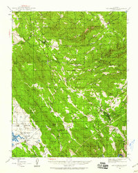
1945 Map of San Andreas
USGS Topo · Published 1959About this map
Gold mining operations and sprawling cattle ranches define the landscape of the Sierra Nevada foothills during the mid-1940s. The town of San Andreas serves as a central hub, flanked by the County Hospital and the industrial Cement Plant at Kentucky House. To the southeast, the historic Mother Lode mining district is densely packed with heavy industry, including the Utica Mine, Lightner Mine, and Angels Mine near the settlement of Angels Camp.
Find a feature on this map
119 named features on this map. Tap any name to fly to it.
Don’t see what you’re looking for? This feature index may not catch every label — zoom into the map to look around manually.
Map Details
Editions of this 1945 San Andreas Map
This is the sole edition of this map. No revisions or reprints were ever made.
Other maps of this area

1889 · Jackson
USGS Topo · 1:125,000

1891 · Big Trees
USGS Topo · 1:125,000

1892 · Jackson
USGS Topo · 1:125,000

1893 · Sonora
USGS Topo · 1:125,000

1894 · Big Trees
USGS Topo · 1:125,000
1896 · Sonora
USGS Topo · 1:125,000

1897 · Jackson
USGS Topo · 1:125,000
1897 · Sonora
USGS Topo · 1:125,000

1897 · Big Trees
USGS Topo · 1:125,000
1898 · Sonora
USGS Topo · 1:125,000