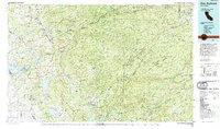
1993 Map of San Andreas
USGS Topo · Published 1994About this map
San Andreas and the Mother Lode region are captured here in the early 1990s, revealing a landscape defined by its deep mining history and complex water management systems. The map traces the historic Gold Country towns of Jackson, Sutter Creek, and Mokelumne Hill, where legacy mines dot the foothills. The terrain transitions from the low-lying Camanche reservoir area to the high-elevation ridges of the Stanislaus National Forest, including notable landmarks like Calaveras Big Trees and Indian Grinding Rock State Historical Park.
Find a feature on this map
112 named features on this map. Tap any name to fly to it.
Don’t see what you’re looking for? This feature index may not catch every label — zoom into the map to look around manually.
Map Details
Editions of this 1993 San Andreas Map
This is the sole edition of this map. No revisions or reprints were ever made.
Other maps of this area

1889 · Jackson
USGS Topo · 1:125,000

1889 · Pyramid Peak
USGS Topo · 1:125,000

1889 · Markleeville
USGS Topo · 1:125,000

1891 · Sacramento
USGS Topo · 1:125,000

1891 · Markleeville
USGS Topo · 1:125,000

1891 · Big Trees
USGS Topo · 1:125,000

1891 · Placerville
USGS Topo · 1:125,000

1891 · Pyramid Peak
USGS Topo · 1:125,000

1892 · Jackson
USGS Topo · 1:125,000

1892 · Sacramento
USGS Topo · 1:125,000