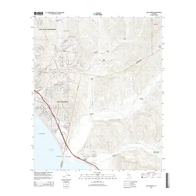
2015 Map of San Clemente
USGS Topo · Published 2015About this map
San Clemente serves as the focal point of this coastal survey, where the suburban street grid meets the rugged canyons and Pacific shoreline. The map documents the intricate residential developments of the area, featuring named thoroughfares like Avenida Victoria and Avenida Palizada that define the local neighborhood character. To the south, the landscape transitions into the preserved coastal stretches of Trestles Beach and San Mateo Point, highlighting a distinct separation between urban growth and natural topography.
Find a feature on this map
131 named features on this map. Tap any name to fly to it.
Don’t see what you’re looking for? This feature index may not catch every label — zoom into the map to look around manually.
Map Details
Editions of this 2015 San Clemente Map
This is the sole edition of this map. No revisions or reprints were ever made.
Other maps of this area

1901 · Southern California Sheet No. 1
USGS Topo · 1:250,000

1901 · Elsinore
USGS Topo · 1:125,000

1901 · San Luis Rey
USGS Topo · 1:125,000

1902 · Capistrano
USGS Topo · 1:125,000

1902 · Corona
USGS Topo · 1:125,000

1904 · Southern California Sheet No. 2
USGS Topo · 1:250,000

1904 · Southern California Sheet No. 1
USGS Topo · 1:250,000

1906 · Capistrano
USGS Topo · 1:125,000

1941 · Margarita Peak
USGS Topo · 1:62,500

1942 · Lake Elsinore
USGS Topo · 1:62,500
Featured Places
- San Clemente, CA
- San Juan Capistrano, CA
- San Onofre, Marine Corps Base Camp Pendleton
- Marine Corps Base Camp Pendleton, CA
- San Diego County, CA