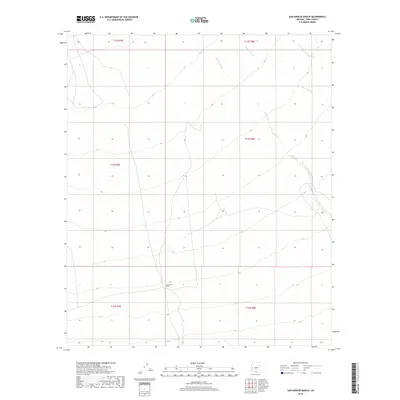
2018 Map of San Ignacio Ranch
USGS Topo · Published 2018About this map
San Ignacio Ranch serves as a lone point of habitation in this arid landscape of the Schuk Toak District, defined by the drainage patterns of the Santa Cruz Valley. The terrain is characterized by a gradual slope from the higher ground in the south, marked by township boundaries t15s r7e and t15s r8e, toward the north as elevations descend toward 2,100 feet. The primary seasonal watercourses, Aguirre Wash and Viopuli Wash, bisect the landscape with braided channels that illustrate the region's flash-flood hydrology. This 2018 survey captures the intersection of established ranching boundaries and the natural drainage systems of Pima County, providing a high-resolution look at the roads and section lines that organize this corner of the Sonoran Desert.
Find a feature on this map
9 named features on this map. Tap any name to fly to it.
Don’t see what you’re looking for? This feature index may not catch every label — zoom into the map to look around manually.
Map Details
Editions of this 2018 San Ignacio Ranch Map
This is the sole edition of this map. No revisions or reprints were ever made.
Other maps of this area

1934 · Tucson Mountains
USGS Topo · 1:125,000

1934 · Silver Bell
USGS Topo · 1:125,000

1938 · San Vicente
USGS Topo · 1:62,500

1941 · San Vicente
USGS Topo · 1:62,500

1941 · Cocoraque Butte
USGS Topo · 1:62,500

1942 · San Vicente
USGS Topo · 1:62,500

1943 · Cocoraque Butte
USGS Topo · 1:62,500

1948 · San Vicente
USGS Topo · 1:62,500

1956 · Tucson
USGS Topo · 1:250,000

1958 · Tucson
USGS Topo · 1:250,000