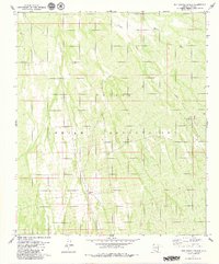
1979 Map of San Ignacio Ranch
USGS Topo · Published 1979About this map
The Papago Indian Reservation dominates this desert landscape in Pima Co, characterized by a complex network of seasonal drainage channels and scattered ranching infrastructure. Arid terrain is defined by the Viopuli Aguirre Wash and Viopuli Wash, which dictate the placement of human activity in this part of the Sonoran Desert. The map serves as a detailed record of water management in an environment where every source is vital, marking a specific Well, a Water Tank, and a Corral used for livestock. The namesake San Ignacio Ranch stands as a primary point of interest for those tracing the history of land use and habitation in this region during the mid-1970s. The absence of major highways or dense settlements highlights the rural and secluded nature of the reservation at this time.
Find a feature on this map
8 named features on this map. Tap any name to fly to it.
Don’t see what you’re looking for? This feature index may not catch every label — zoom into the map to look around manually.
Map Details
Editions of this 1979 San Ignacio Ranch Map
This is the sole edition of this map. No revisions or reprints were ever made.
Other maps of this area

1934 · Tucson Mountains
USGS Topo · 1:125,000

1934 · Silver Bell
USGS Topo · 1:125,000

1938 · San Vicente
USGS Topo · 1:62,500

1941 · San Vicente
USGS Topo · 1:62,500

1941 · Cocoraque Butte
USGS Topo · 1:62,500

1942 · San Vicente
USGS Topo · 1:62,500

1943 · Cocoraque Butte
USGS Topo · 1:62,500

1948 · San Vicente
USGS Topo · 1:62,500

1956 · Tucson
USGS Topo · 1:250,000

1958 · Tucson
USGS Topo · 1:250,000