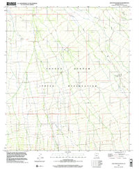
1996 Map of San Ignacio Ranch
USGS Topo · Published 2002About this map
The Tohono O'odham Indian Reservation dominates this desert landscape in Pima County, reflecting the deep cultural geography of southern Arizona. Water management is the primary narrative of this arid environment, evidenced by scattered features like a Water Tank and Well that sustain activity away from the intermittent drainages of Viopuli Wash and Aguirre Wash. The eponymous San Ignacio Ranch serves as a focal point for settlement, accompanied by a small Cem that provides a tangible link to the families and individuals who lived on this land. This survey, compiled from 1974 topography and 1996 imagery, captures the intersection of traditional reservation boundaries and early ranching infrastructure during the late twentieth century.
Find a feature on this map
8 named features on this map. Tap any name to fly to it.
Don’t see what you’re looking for? This feature index may not catch every label — zoom into the map to look around manually.
Map Details
Editions of this 1996 San Ignacio Ranch Map
This is the sole edition of this map. No revisions or reprints were ever made.
Other maps of this area

1934 · Tucson Mountains
USGS Topo · 1:125,000

1934 · Silver Bell
USGS Topo · 1:125,000

1938 · San Vicente
USGS Topo · 1:62,500

1941 · San Vicente
USGS Topo · 1:62,500

1941 · Cocoraque Butte
USGS Topo · 1:62,500

1942 · San Vicente
USGS Topo · 1:62,500

1943 · Cocoraque Butte
USGS Topo · 1:62,500

1948 · San Vicente
USGS Topo · 1:62,500

1956 · Tucson
USGS Topo · 1:250,000

1958 · Tucson
USGS Topo · 1:250,000