Loading...
Loading map...2022 Map of San Isidro
USGS Topo · Published 2022About this map
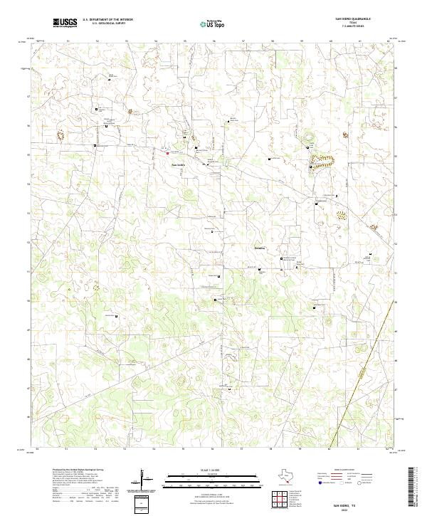
The community of San Isidro and the nearby settlement of Delmita anchor this rural ranching landscape in northern Starr County. The territory is defined by a dense concentration of family and community burial grounds, illustrating the deep ancestral roots tied to the South Texas brush country. These sites, such as the Nieves Garcia Senior Memorial Cem and Rancho Viejo Cem, are often situated at the ends of long ranch roads like Andrews Ranch Rd and Santa Elena Rd.
Find a feature on this map
52 named features on this map. Tap any name to fly to it.
Don’t see what you’re looking for? This feature index may not catch every label — zoom into the map to look around manually.
Map Details
Date Portrayed2022
Date Published2022
PublisherU.S. Geological Survey
Map TypeTopographic
Scale1:24000
Physical Dimensions24 x 29 inches
Editions of this 2022 San Isidro Map
This is the sole edition of this map. No revisions or reprints were ever made.
Historical Maps of Old Santa Elena Through Time
Featured Locations
Source Details
SourceU.S. Geological Survey
CopyrightPublic Domain