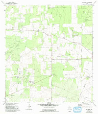
1972 Map of San Isidro
USGS Topo · Published 1993About this map
San Isidro and Santa Elena anchor this South Texas landscape during a period of significant petroleum development in the early 1970s. The region is defined by a dense concentration of family-named cemeteries, including Montalvo Cem, Rancho Viejo Cem, and Olivares Cem, which speak to the deep-rooted ranching heritage of the Rio Grande Valley. These quiet landmarks stand in contrast to the industrial footprint of the Sun Oil Field and the La Reforma Oil and Gas Field, where pipelines, a Gas Plant, and pumping stations crisscross the brush country.
Find a feature on this map
31 named features on this map. Tap any name to fly to it.
Don’t see what you’re looking for? This feature index may not catch every label — zoom into the map to look around manually.
Map Details
Editions of this 1972 San Isidro Map
2 editions found
Other maps of this area

1938 · Agua Nueva
USGS Topo · 1:62,500

1938 · Sal Colorada
USGS Topo · 1:62,500

1939 · La Reforma
USGS Topo · 1:62,500

1939 · Encantada
USGS Topo · 1:62,500

1949 · Mc Allen
USGS Topo · 1:250,000

1954 · McAllen
USGS Topo · 1:250,000

1957 · Mc Allen
USGS Topo · 1:250,000

1962 · McAllen
USGS Topo · 1:250,000
1972 · Santa Elena SE
USGS Topo · 1:24,000
1972 · San Isidro
USGS Topo · 1:24,000