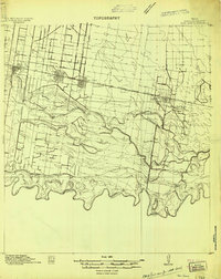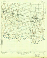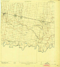
1914 Map of San Juan
USGS Topo · Published 1914About this map
The Rio Grande meanders along the southern border of this landscape, defining the international boundary between Texas and Tamaulipas. At this time, the Rio Grande Valley was undergoing a significant transformation from agricultural tracts like Valley View Plantation and San Juan Plantation toward more structured township development. The railroad network of the St Louis Brownsville and Mexico railway provided the vital economic artery for this growth, connecting Mc Allen, Pharr, San Juan, and Donna in a tight corridor just north of the ancient oxbow lakes and abandoned river channels. These features, known locally as resacas, include the Resaca Sardinas and Resaca La Cruz, which dominate the central terrain. These natural reservoirs were essential for irrigation, supporting the transition from cattle ranching to commercial farming that would soon define the region's identity.
Find a feature on this map
23 named features on this map. Tap any name to fly to it.
Don’t see what you’re looking for? This feature index may not catch every label — zoom into the map to look around manually.
Map Details
Editions of this 1914 San Juan Map
2 editions found