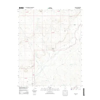
2013 Map of San Luis
USGS Topo · Published 2013About this map
The Rio Puerco carves a winding path through this high-desert landscape in Sandoval County, anchoring a region of mesas and arroyos. The settlement of San Luis sits on the northern bank of the river, positioned between the expansive Bosque Grande Mesa and the prominent Mesa San Luis. This 2013 survey illustrates a landscape defined by traditional ranching and land divisions, where isolated outposts like Cuevitas Camp and water sources such as Divide Tank and Cerro Colorado Tank are essential for navigating the arid terrain. To the south, the settlement of Cabezon lies near the bend of the river, shadowed by Angostura Hill. The complex drainage network, including Arroyo de los Cerros Colorados and Arroyo Cuevitas, highlights the geological character of the Rio Puerco Valley, while local roads like Co Road 85 and W Ridge RD provide the primary connections through these high basins.
Find a feature on this map
30 named features on this map. Tap any name to fly to it.
Don’t see what you’re looking for? This feature index may not catch every label — zoom into the map to look around manually.
Map Details
Editions of this 2013 San Luis Map
This is the sole edition of this map. No revisions or reprints were ever made.
Other maps of this area

1883 · Mt. Taylor
USGS Topo · 1:250,000

1886 · Mt. Taylor
USGS Topo · 1:250,000

1890 · Jemes
USGS Topo · 1:125,000

1892 · Jemes
USGS Topo · 1:125,000

1892 · Mt. Taylor
USGS Topo · 1:250,000

1899 · Mt. Taylor
USGS Topo · 1:250,000

1939 · La Ventana
USGS Topo · 1:62,500

1939 · San Ysidro
USGS Topo · 1:62,500

1943 · San Ysidro
USGS Topo · 1:62,500

1943 · La Ventana
USGS Topo · 1:62,500