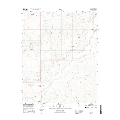
2017 Map of San Luis
USGS Topo · Published 2017About this map
San Luis and Cabezon anchor the high-desert landscape of this recent survey, centered on the ancient drainage of the Rio Puerco. The topography is dominated by significant landforms such as Bosque Grande Mesa and Mesa San Luis, while the Continental Divide National Scenic Trail winds across the northwestern townships. Evidence of the region’s traditional ranching and water management is seen in the numerous tanks scattered across the arid terrain, including Cerro Colorado Tank and Cabezon Tank Number 6. The map provides a clear look at the transition from high points like Angostura Hill to the complex arroyo systems of Arroyo Chavez and Arroyo Alamito. This modern data from the U.S. Geological Survey captures the enduring isolation and physical geography of northwestern New Mexico as it appeared in the mid-2010s.
Find a feature on this map
30 named features on this map. Tap any name to fly to it.
Don’t see what you’re looking for? This feature index may not catch every label — zoom into the map to look around manually.
Map Details
Editions of this 2017 San Luis Map
This is the sole edition of this map. No revisions or reprints were ever made.
Other maps of this area

1883 · Mt. Taylor
USGS Topo · 1:250,000

1886 · Mt. Taylor
USGS Topo · 1:250,000

1890 · Jemes
USGS Topo · 1:125,000

1892 · Jemes
USGS Topo · 1:125,000

1892 · Mt. Taylor
USGS Topo · 1:250,000

1899 · Mt. Taylor
USGS Topo · 1:250,000

1939 · La Ventana
USGS Topo · 1:62,500

1939 · San Ysidro
USGS Topo · 1:62,500

1943 · San Ysidro
USGS Topo · 1:62,500

1943 · La Ventana
USGS Topo · 1:62,500