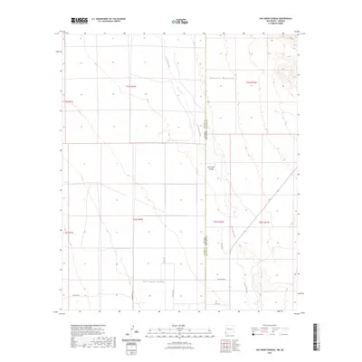
2023 Map of San Simon Cienega
USGS Topo · Published 2023About this map
San Simon Cienega sits at the heart of this borderland landscape where the high desert terrain of the San Simon Valley meets the rising slopes of the Peloncillo Mountains. This survey captures the arid geography along the Arizona-New Mexico state line, specifically the transition from Cochise and Hidalgo counties. The hydrological character of the region is defined by the San Simon River, which provides a vital water source in an otherwise dry expanse. Modern land use is indicated by a network of rural routes such as W Whetten Rd, S Coati Trl, and Swift Trl, which connect the scattered points of human activity within the valley. The map documents the precise intersection of public land survey systems across the state boundary, reflecting the ongoing significance of these jurisdictional lines in managing the desert landscape.
Find a feature on this map
20 named features on this map. Tap any name to fly to it.
Don’t see what you’re looking for? This feature index may not catch every label — zoom into the map to look around manually.
Map Details
Editions of this 2023 San Simon Cienega Map
This is the sole edition of this map. No revisions or reprints were ever made.
Other maps of this area

1917 · San Simon
USGS Topo · 1:125,000

1917 · Chiricahua
USGS Topo · 1:125,000

1918 · Pratt
USGS Topo · 1:62,500

1919 · Pratt
USGS Topo · 1:62,500

1919 · Chiricahua
USGS Topo · 1:125,000

1926 · Rodeo
USGS Topo · 1:62,500

1928 · Chenoweth
USGS Topo · 1:62,500

1950 · Vanar
USGS Topo · 1:62,500

1951 · Vanar
USGS Topo · 1:62,500

1954 · Silver City
USGS Topo · 1:250,000