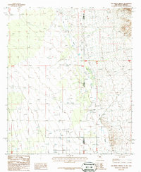
1987 Map of San Simon Cienega
USGS Topo · Published 1987About this map
San Simon River meanders across the state boundary of Arizona and New Mexico in this 1980s landscape of the high desert. The area is defined by the San Simon Cienega, a vital wetland system indicated by numerous wells scattered throughout the valley floor. Human activity is concentrated around Cienega Ranch, which includes a nearby Cem and a Landing Strip for regional access. The map reveals the logistical realities of this border region, where Cochise and Hidalgo counties meet amidst a terrain marked by intermittent water sources and small-scale industrial features like a Gravel pit. This survey documents a quiet ranching and riparian corridor before modern developments altered the character of these western wetlands.
Find a feature on this map
9 named features on this map. Tap any name to fly to it.
Don’t see what you’re looking for? This feature index may not catch every label — zoom into the map to look around manually.
Map Details
Editions of this 1987 San Simon Cienega Map
This is the sole edition of this map. No revisions or reprints were ever made.
Other maps of this area

1917 · San Simon
USGS Topo · 1:125,000

1917 · Chiricahua
USGS Topo · 1:125,000

1918 · Pratt
USGS Topo · 1:62,500

1919 · Pratt
USGS Topo · 1:62,500

1919 · Chiricahua
USGS Topo · 1:125,000

1926 · Rodeo
USGS Topo · 1:62,500

1928 · Chenoweth
USGS Topo · 1:62,500

1950 · Vanar
USGS Topo · 1:62,500

1951 · Vanar
USGS Topo · 1:62,500

1954 · Silver City
USGS Topo · 1:250,000