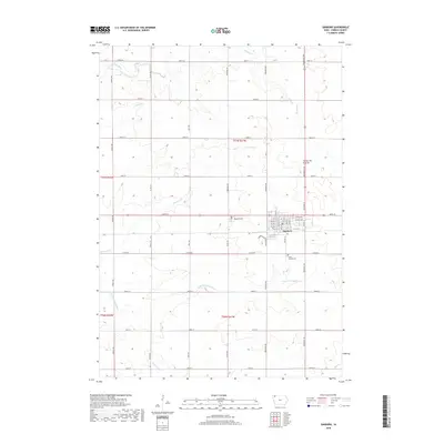
2018 Map of Sanborn
USGS Topo · Published 2018About this map
The town of Sanborn serves as the primary hub of this O'Brien County landscape, situated atop the prominent geological upland known as the Coteau des Prairies. This plateau region is defined by a dense network of watercourses that drain the surrounding agricultural plains, including the winding paths of the Floyd River and its various tributaries like Engels Cr and Sweeney Cr. The map captures the organized section-line grid typical of the American Midwest, where long straight thoroughfares such as Roosevelt Ave and Oriole Ave partition the terrain.
Find a feature on this map
49 named features on this map. Tap any name to fly to it.
Don’t see what you’re looking for? This feature index may not catch every label — zoom into the map to look around manually.
Map Details
Editions of this 2018 Sanborn Map
This is the sole edition of this map. No revisions or reprints were ever made.
Other maps of this area

1954 · Fairmont
USGS Topo · 1:250,000

1958 · Fairmont
USGS Topo · 1:250,000

1964 · Sheldon SE
USGS Topo · 1:24,000

1964 · Sheldon
USGS Topo · 1:24,000

1964 · Primghar
USGS Topo · 1:24,000

1964 · Plessis
USGS Topo · 1:24,000

1964 · Gaza
USGS Topo · 1:24,000

1964 · Sanborn
USGS Topo · 1:24,000

1972 · Ashton
USGS Topo · 1:24,000

1972 · Cloverdale
USGS Topo · 1:24,000