
1964 Map of Sanborn
USGS Topo · Published 1966About this map
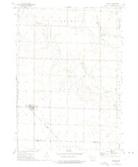
Sanborn sits as the central hub of this prairie landscape, where the Chicago Milwaukee St Paul and Pacific railroad cuts a straight east-west line through O'Brien Co. This mid-century survey reveals an agricultural community defined by the intricate drainage of the Floyd River and its various tributaries, including Engels Creek and Sweeney Creek. The map documents the spatial relationship between the town and its local landmarks, such as Roseland Cem to the north and St Cecilia Cem to the south. Numerous Gravel Pits and Gravel Pits dot the countryside, particularly near the river bends, indicating the local extraction industry that supported road building and infrastructure. To the south, the terrain of Summit township gives way to the headwaters of Mill Creek, illustrating the divide between the Floyd and Big Sioux drainage basins.
Find a feature on this map
18 named features on this map. Tap any name to fly to it.
Don’t see what you’re looking for? This feature index may not catch every label — zoom into the map to look around manually.
Map Details
Editions of this 1964 Sanborn Map
This is the sole edition of this map. No revisions or reprints were ever made.
Other maps of this area

1954 · Fairmont
USGS Topo · 1:250,000

1958 · Fairmont
USGS Topo · 1:250,000

1964 · Sheldon SE
USGS Topo · 1:24,000

1964 · Sheldon
USGS Topo · 1:24,000

1964 · Primghar
USGS Topo · 1:24,000

1964 · Plessis
USGS Topo · 1:24,000

1964 · Gaza
USGS Topo · 1:24,000

1972 · Ashton
USGS Topo · 1:24,000

1972 · Cloverdale
USGS Topo · 1:24,000
1972 · Melvin
USGS Topo · 1:24,000