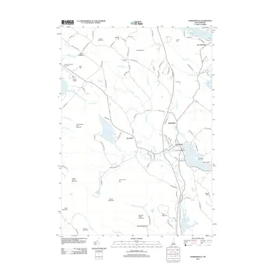
2012 Map of Sanbornville
USGS Topo · Published 2012About this map
Sanbornville and Wakefield serve as the primary nodes of activity in this pocket of Carroll County, where the transition between lowland water bodies and the granite peaks of the Moose Mountains defines the local geography. The landscape is characterized by a series of significant lakes including Lovell Lake, Great East Lake, and Lake Wentworth, which support recreational sites like Lovell Lake Beach and Camp Birchmont. In the west, the Governor Wentworth State Farm preserves a portion of the area's agricultural heritage near the base of Clows Hill. Historically significant mountain peaks such as Cotton Mountain and Copple Crown Mountain flank the central valley, while smaller settlements like Brookfield and Stoneham Corners are linked by a network of winding local roads including Cotton Valley Rd and Pinkham Way.
Find a feature on this map
116 named features on this map. Tap any name to fly to it.
Don’t see what you’re looking for? This feature index may not catch every label — zoom into the map to look around manually.
Map Details
Editions of this 2012 Sanbornville Map
This is the sole edition of this map. No revisions or reprints were ever made.
Other maps of this area

1891 · Berwick
USGS Topo · 1:62,500

1891 · Newfield
USGS Topo · 1:62,500

1893 · Berwick
USGS Topo · 1:62,500

1893 · Newfield
USGS Topo · 1:62,500

1919 · Alton
USGS Topo · 1:62,500

1928 · Wolfeboro
USGS Topo · 1:62,500

1933 · Berwick
USGS Topo · 1:48,000

1933 · Newfield
USGS Topo · 1:48,000

1937 · Newfield
USGS Topo · 1:62,500

1937 · Berwick
USGS Topo · 1:62,500