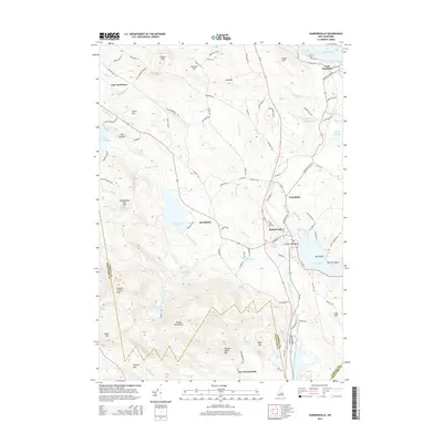
2015 Map of Sanbornville
USGS Topo · Published 2015About this map
Sanbornville and Wakefield serve as the primary hubs in this lake-rich landscape of Carroll County. The terrain is defined by a dense network of water bodies, including the expansive Lovell Lake and portions of Great East Lake and Lake Wentworth. High elevations like Copple Crown Mtn and the Moose Mountains overlook these basins, illustrating the complex drainage patterns that feed Br River and various brooks such as Pike Brook and Scribner Brook.
Find a feature on this map
102 named features on this map. Tap any name to fly to it.
Don’t see what you’re looking for? This feature index may not catch every label — zoom into the map to look around manually.
Map Details
Editions of this 2015 Sanbornville Map
This is the sole edition of this map. No revisions or reprints were ever made.
Other maps of this area

1891 · Berwick
USGS Topo · 1:62,500

1891 · Newfield
USGS Topo · 1:62,500

1893 · Berwick
USGS Topo · 1:62,500

1893 · Newfield
USGS Topo · 1:62,500

1919 · Alton
USGS Topo · 1:62,500

1928 · Wolfeboro
USGS Topo · 1:62,500

1933 · Berwick
USGS Topo · 1:48,000

1933 · Newfield
USGS Topo · 1:48,000

1937 · Newfield
USGS Topo · 1:62,500

1937 · Berwick
USGS Topo · 1:62,500