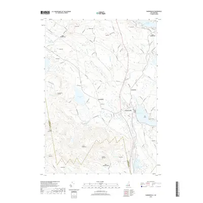
2018 Map of Sanbornville
USGS Topo · Published 2018About this map
The Moose Mountains and several interconnected glacial lakes anchor the settlement patterns of Carroll County in this 2018 survey. The village of Sanbornville serves as a central hub near the southern shore of Lovell Lake, where Lovell Lake Beach marks a primary recreational point. The landscape is a mix of high-relief peaks like Copple Crown Mtn and Tumbledown Dick Mtn, separated by intricate drainage networks including Copp Brook and Warren Brook. To the north, the terrain transitions into the valleys surrounding Kingswood Lake and the smaller community of Brookfield. This map documents the persistent rural character of the region, where older settlements like East Wolfeboro and Wakefield remain connected by historic corridors such as Cotton Valley Rd and Wakefield Rd. The southern boundary reveals the transition into Strafford County near the locality of New Portsmouth.
Find a feature on this map
103 named features on this map. Tap any name to fly to it.
Don’t see what you’re looking for? This feature index may not catch every label — zoom into the map to look around manually.
Map Details
Editions of this 2018 Sanbornville Map
This is the sole edition of this map. No revisions or reprints were ever made.
Other maps of this area

1891 · Berwick
USGS Topo · 1:62,500

1891 · Newfield
USGS Topo · 1:62,500

1893 · Berwick
USGS Topo · 1:62,500

1893 · Newfield
USGS Topo · 1:62,500

1919 · Alton
USGS Topo · 1:62,500

1928 · Wolfeboro
USGS Topo · 1:62,500

1933 · Berwick
USGS Topo · 1:48,000

1933 · Newfield
USGS Topo · 1:48,000

1937 · Newfield
USGS Topo · 1:62,500

1937 · Berwick
USGS Topo · 1:62,500