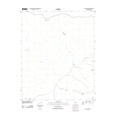
2012 Map of Sand Canyon
USGS Topo · Published 2012About this map
Villard Ranch and Carlton Ranch sit within a landscape of deeply cut drainages and winding country roads in this Kern County survey. The terrain is defined by a series of prominent gulches and canyons, including Sand Canyon, Horse Canyon, and Coyote Gulch, which guide the seasonal flow of waterways like Five Dog Cr and Willow Spring Cr. These drainages serve as the primary markers for navigation in an area characterized by dispersed ranching and localized water sources such as Willow Spring and Carver Spring.
Find a feature on this map
24 named features on this map. Tap any name to fly to it.
Don’t see what you’re looking for? This feature index may not catch every label — zoom into the map to look around manually.
Map Details
Editions of this 2012 Sand Canyon Map
This is the sole edition of this map. No revisions or reprints were ever made.
Other maps of this area

1906 · Bakersfield
USGS Topo · 1:62,500

1926 · Quincy School
USGS Topo · 1:31,680

1929 · Richgrove
USGS Topo · 1:31,680

1929 · Quincy School
USGS Topo · 1:31,680

1931 · Deepwell Ranch
USGS Topo · 1:31,680

1932 · North of Oildale
USGS Topo · 1:31,680

1932 · Woody
USGS Topo · 1:62,500

1935 · Woody
USGS Topo · 1:62,500

1936 · White River
USGS Topo · 1:62,500
1936 · North of Oildale
USGS Topo · 1:31,680