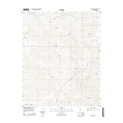
2015 Map of Sand Canyon
USGS Topo · Published 2015About this map
Sand Canyon provides the centerpiece for this geographic study of the transition where the Central Valley meets the foothills of the Sierra Nevada. The landscape is defined by a dense network of intermittent drainage systems, including Five Dog Cr, Dead Ox Cr, and Nightingale Gulch, which reveal the erosional patterns of this arid region.
Find a feature on this map
28 named features on this map. Tap any name to fly to it.
Don’t see what you’re looking for? This feature index may not catch every label — zoom into the map to look around manually.
Map Details
Editions of this 2015 Sand Canyon Map
This is the sole edition of this map. No revisions or reprints were ever made.
Other maps of this area

1906 · Bakersfield
USGS Topo · 1:62,500

1926 · Quincy School
USGS Topo · 1:31,680

1929 · Richgrove
USGS Topo · 1:31,680

1929 · Quincy School
USGS Topo · 1:31,680

1931 · Deepwell Ranch
USGS Topo · 1:31,680

1932 · North of Oildale
USGS Topo · 1:31,680

1932 · Woody
USGS Topo · 1:62,500

1935 · Woody
USGS Topo · 1:62,500

1936 · White River
USGS Topo · 1:62,500
1936 · North of Oildale
USGS Topo · 1:31,680