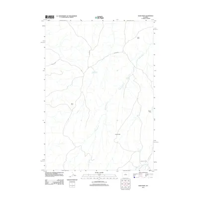
2012 Map of Sand Point
USGS Topo · Published 2012About this map
Orchards Cow Camp sits in the southern reaches of this Wyoming landscape, representing the enduring ranching character of Washakie County. The terrain is defined by a series of drainage systems and ridges, including the prominent Shanty Ridge and the distinct elevation of Chalk Butte. Seasonal water management is evident at the Cottonwood Trail Reservoir, while the natural flow of Buffalo Springs Cr and the W Fork Buffalo Cr carve through the high plains. Remote access is provided by unpaved tracks such as Blue Bank Rd and the aptly named Devils Slide Rd, which navigate the complex topography near Sand Point. These labels reveal a landscape primarily utilized for livestock and resource management, where named draws like Brome Draw mark the subtle shifts in the arid environment.
Find a feature on this map
10 named features on this map. Tap any name to fly to it.
Don’t see what you’re looking for? This feature index may not catch every label — zoom into the map to look around manually.
Map Details
Editions of this 2012 Sand Point Map
This is the sole edition of this map. No revisions or reprints were ever made.
Other maps of this area

1952 · Battle Mountain
USGS Topo · 1:24,000

1952 · Bull Mountain
USGS Topo · 1:24,000

1955 · Arminto
USGS Topo · 1:250,000

1958 · Arminto
USGS Topo · 1:250,000

1962 · Arminto
USGS Topo · 1:250,000

1966 · Deadline Draw
USGS Topo · 1:24,000

1966 · Indian Creek
USGS Topo · 1:24,000

1966 · Sand Point
USGS Topo · 1:24,000

1966 · Wagon Prong
USGS Topo · 1:24,000

1966 · Bader Draw
USGS Topo · 1:24,000