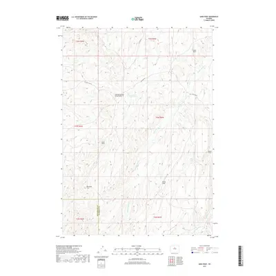
2017 Map of Sand Point
USGS Topo · Published 2017About this map
The high plains of Wyoming meet the southern boundary of Washakie County along this 2017 survey, where the Hot Springs Co Washakie Co line cuts through a landscape defined by intermittent water and high points. Landmarks such as Sand Point and Chalk Butte provide navigational anchors in a region where local drainage follows features like Blue Bank Draw and Brome Draw. The infrastructure here is sparse, characterized by dirt routes such as Blue Bank Rd and Devils Slide Rd, reflecting a landscape primarily used for ranching and water management.
Find a feature on this map
20 named features on this map. Tap any name to fly to it.
Don’t see what you’re looking for? This feature index may not catch every label — zoom into the map to look around manually.
Map Details
Editions of this 2017 Sand Point Map
This is the sole edition of this map. No revisions or reprints were ever made.
Other maps of this area

1952 · Battle Mountain
USGS Topo · 1:24,000

1952 · Bull Mountain
USGS Topo · 1:24,000

1955 · Arminto
USGS Topo · 1:250,000

1958 · Arminto
USGS Topo · 1:250,000

1962 · Arminto
USGS Topo · 1:250,000

1966 · Deadline Draw
USGS Topo · 1:24,000

1966 · Indian Creek
USGS Topo · 1:24,000

1966 · Sand Point
USGS Topo · 1:24,000

1966 · Wagon Prong
USGS Topo · 1:24,000

1966 · Bader Draw
USGS Topo · 1:24,000