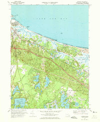
1972 Map of Sandwich
USGS Topo · Published 1973About this map
Sandwich and the northern shores of Barnstable are characterized here by a dense network of glacial kettle ponds and coastal marshes in the early 1970s. The landscape is dominated by the Mid-Cape Highway corridor and the heavy industrial presence of the Cape Cod Canal to the west. Evidence of the region’s long agrarian and maritime history remains in the numerous small cemeteries like Cedarville Cem and Percival Cem, alongside the extensive Cranberry Bogs that dot the lowlands between Scorton Hill and Discovery Hill.
Find a feature on this map
131 named features on this map. Tap any name to fly to it.
Don’t see what you’re looking for? This feature index may not catch every label — zoom into the map to look around manually.
Map Details
Editions of this 1972 Sandwich Map
3 editions found
Other maps of this area

1886 · Falmouth
USGS Topo · 1:62,500

1886 · Plymouth
USGS Topo · 1:62,500

1888 · Barnstable
USGS Topo · 1:62,500

1888 · Falmouth
USGS Topo · 1:62,500

1889 · Plymouth
USGS Topo · 1:62,500

1893 · Barnstable
USGS Topo · 1:62,500

1893 · Falmouth
USGS Topo · 1:62,500

1894 · Plymouth
USGS Topo · 1:62,500

1915 · Falmouth
USGS Topo · 1:62,500

1920 · Falmouth
USGS Topo · 1:62,500