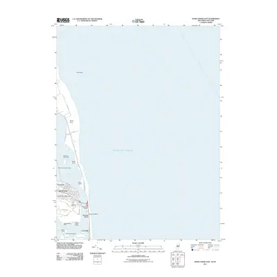
2011 Map of Sandy Hook East
USGS Topo · Published 2011About this map
Gateway National Rec Area dominates this coastal landscape, protecting the shifting sands of Sandy Hook and the surrounding maritime environment. The Atlantic Ocean meets the Jersey Shore here, where the land narrows into a peninsula flanked by Sandy Hook Bay. Inland, the high ground is marked by the Navesink Lighthouse, overlooking the coastal settlements of Highlands and Waterwitch. The map reveals a transition from these established communities to the barrier beaches of Highlands Beach and Navesink Beach. Smaller islands and landmarks such as Skeleton Hill Island, Plum Island, and the Highlands Seaplane Base illustrate the region's diverse use of its land-sea interface. Along the Navesink River, features like Upper Rocky Point and Lower Rocky Point define the northern bank near the residential area of Normandie.
Find a feature on this map
36 named features on this map. Tap any name to fly to it.
Don’t see what you’re looking for? This feature index may not catch every label — zoom into the map to look around manually.
Map Details
Editions of this 2011 Sandy Hook East Map
This is the sole edition of this map. No revisions or reprints were ever made.
Other maps of this area

1888 · Sandy Hook
USGS Topo · 1:62,500

1889 · Brooklyn
USGS Topo · 1:62,500

1891 · Brooklyn
USGS Topo · 1:62,500

1893 · Sandy Hook
USGS Topo · 1:62,500

1897 · Brooklyn
USGS Topo · 1:62,500

1898 · Staten Island
USGS Topo · 1:62,500

1898 · Brooklyn
USGS Topo · 1:62,500

1900 · Passaic
USGS Topo · 1:125,000

1900 · Staten Island
USGS Topo · 1:62,500

1900 · Brooklyn
USGS Topo · 1:62,500