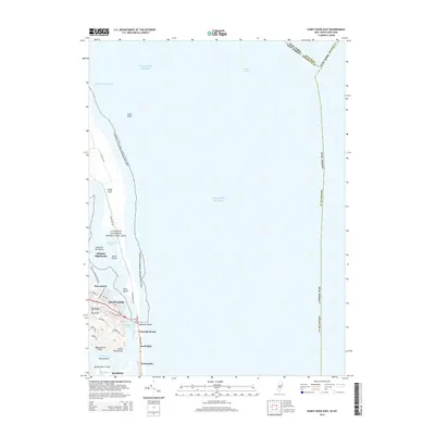
2014 Map of Sandy Hook East
USGS Topo · Published 2014About this map
Gateway National Recreation Area dominates the peninsula of this coastal survey, where the narrow landform of Sandy Hook separates the Atlantic Ocean from the complex inner waterways. The terrain is marked by shifting sands and small islands such as Skeleton Hill Island and South Island within Spermaceti Cove. On the mainland, the elevation rises sharply toward Atlantic Highlands and the Highlands of Navesink, overlooking the confluence of the Navesink River and Shrewsbury River. This 2014 mapping reveals a landscape shaped by coastal defense and recreation, with Hartshorne Dr and Atlantic Dr providing access to the peninsula. Southward, the residential and vacation corridor along Ocean Ave connects coastal communities like Sea Bright, Navesink Beach, and Normandie along the thin barrier beach.
Find a feature on this map
40 named features on this map. Tap any name to fly to it.
Don’t see what you’re looking for? This feature index may not catch every label — zoom into the map to look around manually.
Map Details
Editions of this 2014 Sandy Hook East Map
This is the sole edition of this map. No revisions or reprints were ever made.
Other maps of this area

1888 · Sandy Hook
USGS Topo · 1:62,500

1889 · Brooklyn
USGS Topo · 1:62,500

1891 · Brooklyn
USGS Topo · 1:62,500

1893 · Sandy Hook
USGS Topo · 1:62,500

1897 · Brooklyn
USGS Topo · 1:62,500

1898 · Staten Island
USGS Topo · 1:62,500

1898 · Brooklyn
USGS Topo · 1:62,500

1900 · Passaic
USGS Topo · 1:125,000

1900 · Staten Island
USGS Topo · 1:62,500

1900 · Brooklyn
USGS Topo · 1:62,500