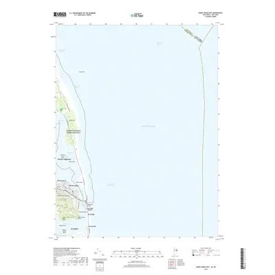
2019 Map of Sandy Hook East
USGS Topo · Published 2019About this map
Gateway National Recreation Area dominates the northern peninsula of this coastal survey, where the land narrows between Raritan Bay and the open Atlantic Ocean. The topography reveals the delicate balance of the Jersey Shore, tracing the thin barrier strips of Highlands Beach and Navesink Beach that protect the Shrewsbury River and Navesink River estuaries. On the mainland, the elevation rises sharply at the Highlands of Navesink, where residential streets like Waterwitch Ave and Navesink Ave navigate the steep slopes of Cuesta Ridge. This area serves as a critical maritime gateway, marked by the deep Ambrose Channel and Sandy Hook Channel providing passage into the harbor. The map highlights the concentrated development of boroughs like Atlantic Highlands and Rumson against the protected salt marshes of Spermaceti Cove and Horseshoe Cove.
Find a feature on this map
48 named features on this map. Tap any name to fly to it.
Don’t see what you’re looking for? This feature index may not catch every label — zoom into the map to look around manually.
Map Details
Editions of this 2019 Sandy Hook East Map
This is the sole edition of this map. No revisions or reprints were ever made.
Other maps of this area

1888 · Sandy Hook
USGS Topo · 1:62,500

1889 · Brooklyn
USGS Topo · 1:62,500

1891 · Brooklyn
USGS Topo · 1:62,500

1893 · Sandy Hook
USGS Topo · 1:62,500

1897 · Brooklyn
USGS Topo · 1:62,500

1898 · Staten Island
USGS Topo · 1:62,500

1898 · Brooklyn
USGS Topo · 1:62,500

1900 · Passaic
USGS Topo · 1:125,000

1900 · Staten Island
USGS Topo · 1:62,500

1900 · Brooklyn
USGS Topo · 1:62,500