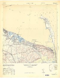
1947 Map of Sandy Hook
USGS Topo · Published 1950About this map
Ft Hancock and the U. S. Military Reservation dominate the northern peninsula of this coastal survey, where the strategic geography of the Atlantic Ocean meets Raritan Bay. The landscape transitions from the military outposts and batteries of the hook to the established maritime and residential communities of Atlantic Highlands, Belford, and Highlands. Commercial piers such as the Standard Oil Co of New Jersey Pier and the Amusement Park Pier underscore the area's mid-century role as both an industrial hub and a destination for recreation.
Find a feature on this map
64 named features on this map. Tap any name to fly to it.
Don’t see what you’re looking for? This feature index may not catch every label — zoom into the map to look around manually.
Map Details
Editions of this 1947 Sandy Hook Map
This is the sole edition of this map. No revisions or reprints were ever made.
Other maps of this area

1888 · Sandy Hook
USGS Topo · 1:62,500

1889 · Brooklyn
USGS Topo · 1:62,500

1891 · Brooklyn
USGS Topo · 1:62,500

1893 · Sandy Hook
USGS Topo · 1:62,500

1897 · Brooklyn
USGS Topo · 1:62,500

1898 · Staten Island
USGS Topo · 1:62,500

1898 · Brooklyn
USGS Topo · 1:62,500

1900 · Passaic
USGS Topo · 1:125,000

1900 · Staten Island
USGS Topo · 1:62,500

1900 · Brooklyn
USGS Topo · 1:62,500