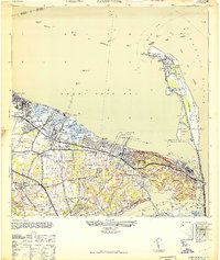
1947 Map of Sandy Hook
USGS Topo · Published 1950About this map
Ft Hancock dominates the northern tip of the peninsula, serving as a critical component of the United States Government Military Reservation at the entrance to New York Harbor. This post-war era survey reveals a landscape defined by maritime commerce and defense, where the New Jersey Central railroad lines connect shore communities like Belford and Atlantic Highlands. The shoreline is heavily industrialized with significant infrastructure, including the Standard Oil Co of New Jersey Pier and the S S Mandalay Pier, reflecting the region's mid-century reliance on coastal shipping and transit.
Find a feature on this map
71 named features on this map. Tap any name to fly to it.
Don’t see what you’re looking for? This feature index may not catch every label — zoom into the map to look around manually.
Map Details
Editions of this 1947 Sandy Hook Map
This is the sole edition of this map. No revisions or reprints were ever made.
Other maps of this area

1888 · Sandy Hook
USGS Topo · 1:62,500

1889 · Brooklyn
USGS Topo · 1:62,500

1891 · Brooklyn
USGS Topo · 1:62,500

1893 · Sandy Hook
USGS Topo · 1:62,500

1897 · Brooklyn
USGS Topo · 1:62,500

1898 · Staten Island
USGS Topo · 1:62,500

1898 · Brooklyn
USGS Topo · 1:62,500

1900 · Passaic
USGS Topo · 1:125,000

1900 · Staten Island
USGS Topo · 1:62,500

1900 · Brooklyn
USGS Topo · 1:62,500