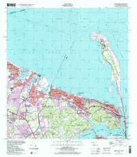
1998 Map of Sandy Hook
USGS Topo · Published 2001About this map
Fort Hancock and the Sandy Hook Lighthouse anchor the narrow peninsula at the northern tip of the New Jersey shore, guarding the entrance to Lower Bay. This coastal landscape is defined by the complex maritime infrastructure required to navigate the Sandy Hook Channel and False Hook Channel. On the mainland, the residential developments of Keansburg, Leonardo, and Highlands are separated from the shoreline by a network of tidal features like Compton Creek and Spermaceti Cove. The land use shows a transition from the dense urban blocks of East Keansburg to the expansive wooded reaches of Hartshorne Woods County Park and Huber Woods County Park. Notable historical landmarks include the Board of Proprietors State Historic Site and the Twin Lights State Historic Site, which overlooks the Navesink River and the narrow strip of Sea Bright.
Find a feature on this map
75 named features on this map. Tap any name to fly to it.
Don’t see what you’re looking for? This feature index may not catch every label — zoom into the map to look around manually.
Map Details
Editions of this 1998 Sandy Hook Map
This is the sole edition of this map. No revisions or reprints were ever made.
Other maps of this area

1888 · Sandy Hook
USGS Topo · 1:62,500

1889 · Brooklyn
USGS Topo · 1:62,500

1891 · Brooklyn
USGS Topo · 1:62,500

1893 · Sandy Hook
USGS Topo · 1:62,500

1897 · Brooklyn
USGS Topo · 1:62,500

1898 · Staten Island
USGS Topo · 1:62,500

1898 · Brooklyn
USGS Topo · 1:62,500

1900 · Passaic
USGS Topo · 1:125,000

1900 · Staten Island
USGS Topo · 1:62,500

1900 · Brooklyn
USGS Topo · 1:62,500