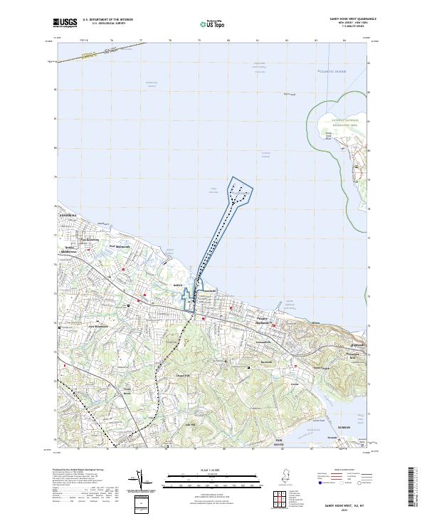
2023 Map of Sandy Hook West
USGS Topo · Published 2023About this map
Sandy Hook Bay and the Lower Bay define this coastal landscape, where the northern tip of Monmouth County meets the waters of the Atlantic Ocean. The geography is dominated by the narrow spit of the Gateway National Recreation Area, leading to Sandy Hook Point. Inland, the terrain rises toward the Highlands of Navesink and Garrett Hill, creating a distinct separation between the low-lying shore communities and the elevated residential areas.
Find a feature on this map
72 named features on this map. Tap any name to fly to it.
Don’t see what you’re looking for? This feature index may not catch every label — zoom into the map to look around manually.
Map Details
Editions of this 2023 Sandy Hook West Map
This is the sole edition of this map. No revisions or reprints were ever made.
Other maps of this area

1888 · Sandy Hook
USGS Topo · 1:62,500

1889 · Brooklyn
USGS Topo · 1:62,500

1891 · Brooklyn
USGS Topo · 1:62,500

1893 · Sandy Hook
USGS Topo · 1:62,500

1897 · Brooklyn
USGS Topo · 1:62,500

1898 · Staten Island
USGS Topo · 1:62,500

1898 · Brooklyn
USGS Topo · 1:62,500

1900 · Passaic
USGS Topo · 1:125,000

1900 · Staten Island
USGS Topo · 1:62,500

1900 · Brooklyn
USGS Topo · 1:62,500