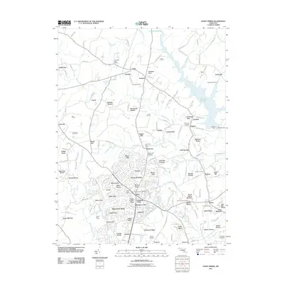
2011 Map of Sandy Spring
USGS Topo · Published 2011About this map
Olney Town and the neighboring village of Brookeville anchor this landscape during a period of significant suburban development in Montgomery County. The map documents a dense network of residential subdivisions such as Olney Mill, Tanterra, and Manor Oaks, which have expanded around older rural landmarks like the Salem United Methodist Cemetery. To the north and east, the terrain remains defined by the Patuxent River and the expansive Tridelphia Reservoir, controlled by the Brighton Dam. This 2011 survey captures the area's transition, where family-named landholdings like Kalmia Farms and Park Overlook Farm sit adjacent to modern amenities like the Blue Mash Golf Course and Norbeck Golf Course. Historical continuity is maintained through the various post offices serving Ashton, Sandy Spring, and Brinklow, while the name Gold Mine Crossing hints at the region's earlier industrial ventures.
Find a feature on this map
177 named features on this map. Tap any name to fly to it.
Don’t see what you’re looking for? This feature index may not catch every label — zoom into the map to look around manually.
Map Details
Editions of this 2011 Sandy Spring Map
This is the sole edition of this map. No revisions or reprints were ever made.
Other maps of this area

1892 · Laurel
USGS Topo · 1:62,500

1892 · Ellicott
USGS Topo · 1:62,500

1893 · Frederick
USGS Topo · 1:125,000

1894 · Ellicott
USGS Topo · 1:62,500

1894 · Laurel
USGS Topo · 1:62,500

1894 · Frederick
USGS Topo · 1:125,000

1897 · Laurel
USGS Topo · 1:62,500

1906 · Ellicott
USGS Topo · 1:62,500

1907 · Laurel
USGS Topo · 1:62,500

1908 · Patapsco
USGS Topo · 1:125,000