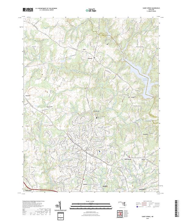
2023 Map of Sandy Spring
USGS Topo · Published 2023About this map
Sandy Spring and Ashton anchor the southern reaches of this landscape, where the agricultural traditions of Montgomery County meet the suburban expansion of the modern era. The topography is defined by the winding course of the Patuxent River and the Hawlings River, which feed into the extensive Triadelphia Reservoir at the northeastern corner. This area is noted for its high density of well-preserved local history sites, including the Saint Lukes Episcopal Church Cem near Brighton and the Salem United Methodist Church Cem in Brookeville. The mapping of small settlements like Unity and Sunshine along Damascus RD shows how historic crossroads have maintained their identity even as regional infrastructure grows. Waterways such as Reddy Branch and James Creek carve through the terrain, illustrating the drainage patterns that shaped early mill sites and settlement boundaries in this portion of the Piedmont.
Find a feature on this map
202 named features on this map. Tap any name to fly to it.
Don’t see what you’re looking for? This feature index may not catch every label — zoom into the map to look around manually.
Map Details
Editions of this 2023 Sandy Spring Map
This is the sole edition of this map. No revisions or reprints were ever made.
Other maps of this area

1892 · Laurel
USGS Topo · 1:62,500

1892 · Ellicott
USGS Topo · 1:62,500

1893 · Frederick
USGS Topo · 1:125,000

1894 · Ellicott
USGS Topo · 1:62,500

1894 · Laurel
USGS Topo · 1:62,500

1894 · Frederick
USGS Topo · 1:125,000

1897 · Laurel
USGS Topo · 1:62,500

1906 · Ellicott
USGS Topo · 1:62,500

1907 · Laurel
USGS Topo · 1:62,500

1908 · Patapsco
USGS Topo · 1:125,000