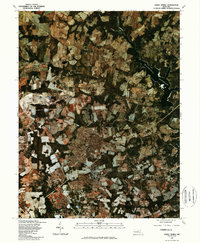
1981 Map of Sandy Spring
USGS Topo · Published 1986About this map
Olney serves as a clear focal point in this 1981 orthophotoquad, showing a distinctive transition from organized suburban expansion to the traditional agricultural patterns of northern Montgomery County. The overhead imagery reveals the patchwork of fields and woodlots that defined the landscape between Brookeville and Sandy Spring before later decades of intense development. To the northeast, the Triadelphia Reservoir dominates the drainage of the Patuxent River, its irregular shoreline contrasting with the straight property lines and grid-like clearings of the surrounding countryside. This specific view, produced in cooperation with the Soil Conservation Service, uses color infrared photography to highlight the health and density of vegetation along the Hawlings River and Cattail Creek. For researchers, the map provides a precise visual baseline of settlement footprints in Ashton and the surrounding rural districts at the start of the 1980s.
Find a feature on this map
8 named features on this map. Tap any name to fly to it.
Don’t see what you’re looking for? This feature index may not catch every label — zoom into the map to look around manually.
Map Details
Editions of this 1981 Sandy Spring Map
This is the sole edition of this map. No revisions or reprints were ever made.
Other maps of this area

1892 · Laurel
USGS Topo · 1:62,500

1892 · Ellicott
USGS Topo · 1:62,500

1893 · Frederick
USGS Topo · 1:125,000

1894 · Ellicott
USGS Topo · 1:62,500

1894 · Laurel
USGS Topo · 1:62,500

1894 · Frederick
USGS Topo · 1:125,000

1897 · Laurel
USGS Topo · 1:62,500

1906 · Ellicott
USGS Topo · 1:62,500

1907 · Laurel
USGS Topo · 1:62,500

1908 · Patapsco
USGS Topo · 1:125,000