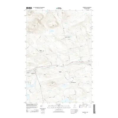
2014 Map of Sangerville
USGS Topo · Published 2014About this map
Lows Bridge spans the Piscataquis River in this survey of south-central Piscataquis County, where the industrial and residential centers of Guilford and Sangerville sit at the river's edge. The landscape is defined by a dense network of water bodies and elevated terrain, from the heights of Guilford Mtn and Buker Mtn to the low-lying reaches of Manhanock Pond and Marr Pond.
Find a feature on this map
93 named features on this map. Tap any name to fly to it.
Don’t see what you’re looking for? This feature index may not catch every label — zoom into the map to look around manually.
Map Details
Editions of this 2014 Sangerville Map
This is the sole edition of this map. No revisions or reprints were ever made.
Other maps of this area

1932 · Dover-Foxcroft
USGS Topo · 1:48,000

1933 · Guilford
USGS Topo · 1:62,500

1935 · Dover-Foxcroft
USGS Topo · 1:62,500

1937 · Guilford
USGS Topo · 1:62,500

1940 · Sebec
USGS Topo · 1:48,000

1943 · Sebec
USGS Topo · 1:62,500

1950 · Sebec Lake
USGS Topo · 1:62,500

1954 · Millinocket
USGS Topo · 1:250,000

1958 · Millinocket
USGS Topo · 1:250,000

1960 · Millinocket
USGS Topo · 1:250,000