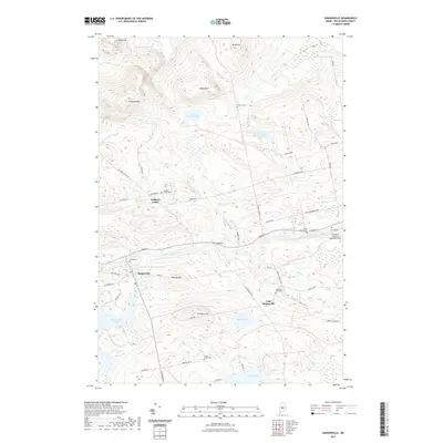
2021 Map of Sangerville
USGS Topo · Published 2021About this map
Sangerville and its surrounding hills dominate this 2021 landscape, where the Piscataquis River flows eastward through a valley defined by agricultural remnants and river-driven history. The map highlights the traditional settlement patterns of Piscataquis County, from the village at Guilford Center to the residential clusters in East Sangerville. Local genealogy is well-preserved through numerous small burying grounds, including the Guilford Center Cem, Village Cem, and the remote Brawn Cem located near the northern slopes of Buker Mtn.
Find a feature on this map
62 named features on this map. Tap any name to fly to it.
Don’t see what you’re looking for? This feature index may not catch every label — zoom into the map to look around manually.
Map Details
Editions of this 2021 Sangerville Map
This is the sole edition of this map. No revisions or reprints were ever made.
Other maps of this area

1932 · Dover-Foxcroft
USGS Topo · 1:48,000

1933 · Guilford
USGS Topo · 1:62,500

1935 · Dover-Foxcroft
USGS Topo · 1:62,500

1937 · Guilford
USGS Topo · 1:62,500

1940 · Sebec
USGS Topo · 1:48,000

1943 · Sebec
USGS Topo · 1:62,500

1950 · Sebec Lake
USGS Topo · 1:62,500

1954 · Millinocket
USGS Topo · 1:250,000

1958 · Millinocket
USGS Topo · 1:250,000

1960 · Millinocket
USGS Topo · 1:250,000