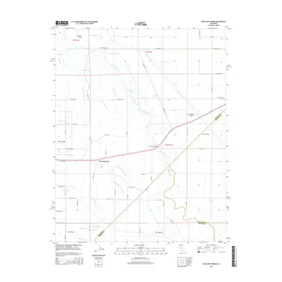
2015 Map of Santa Rita Bridge
USGS Topo · Published 2015About this map
Santa Rita Park sits at the heart of an intricate network of water management features in the San Joaquin Valley, where the San Joaquin River and various sloughs define the landscape. This 2015 study reveals a complex system of canals and ditches, such as the Temple Santa Rita Canal and Riverside Canal, designed to distribute water across the low-lying agricultural terrain. The map captures the intersection of several county boundaries, including the meeting points of Merced, Madera, and Fresno counties.
Find a feature on this map
56 named features on this map. Tap any name to fly to it.
Don’t see what you’re looking for? This feature index may not catch every label — zoom into the map to look around manually.
Map Details
Editions of this 2015 Santa Rita Bridge Map
This is the sole edition of this map. No revisions or reprints were ever made.
Other maps of this area

1913 · Panoche
USGS Topo · 1:125,000

1916 · Santa Rita Bridge
USGS Topo · 1:24,000

1916 · Delta Ranch
USGS Topo · 1:24,000

1918 · Bliss Ranch
USGS Topo · 1:31,680

1918 · Lingard
USGS Topo · 1:31,680

1918 · Sandy Mush
USGS Topo · 1:31,680

1918 · Turner Ranch
USGS Topo · 1:31,680

1920 · Santa Rita Bridge
USGS Topo · 1:31,680

1922 · Oxalis
USGS Topo · 1:31,680

1922 · Santa Rita Bridge
USGS Topo · 1:31,680