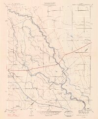
1948 Map of Santa Rita Bridge
USGS Topo · Published 1948About this map
The San Joaquin River and its complex network of sloughs and canals dominate this post-war survey of the San Joaquin Valley. Mapping the confluence where the Fresno River and Chowchilla River meet the San Joaquin, the landscape is defined by large agricultural holdings and an intricate irrigation system including the Poso Canal and San Juan Canal. The prevalence of named agricultural properties like Lucerne Farm, Santa Rita Ranch, and Colony Farm illustrates the transition from open range to organized commercial farming. Local industry and infrastructure are anchored by the Santa Rita Bridge and Wolfsen Mill, while the Red Top Ranch Airport indicates the growing role of aviation in managing these expansive valley estates. Numerous windmills dot the sections, marking the vital groundwater points that sustained these ranches in the late 1940s.
Find a feature on this map
32 named features on this map. Tap any name to fly to it.
Don’t see what you’re looking for? This feature index may not catch every label — zoom into the map to look around manually.
Map Details
Editions of this 1948 Santa Rita Bridge Map
This is the sole edition of this map. No revisions or reprints were ever made.
Other maps of this area

1913 · Panoche
USGS Topo · 1:125,000

1916 · Santa Rita Bridge
USGS Topo · 1:24,000

1916 · Delta Ranch
USGS Topo · 1:24,000

1918 · Bliss Ranch
USGS Topo · 1:31,680

1918 · Lingard
USGS Topo · 1:31,680

1918 · Sandy Mush
USGS Topo · 1:31,680

1918 · Turner Ranch
USGS Topo · 1:31,680

1920 · Santa Rita Bridge
USGS Topo · 1:31,680

1922 · Oxalis
USGS Topo · 1:31,680

1922 · Santa Rita Bridge
USGS Topo · 1:31,680