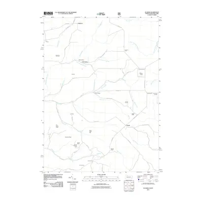
2011 Map of Scandia
USGS Topo · Published 2011About this map
Scandia and Gouldtown anchor this 2011 survey of the Pennsylvania-New York borderlands, a landscape defined by sharp ridges and a dense network of mountain runs. The border itself is traced by the South Branch State Line Run and State Line Run, separating Chautauqua County from the Pennsylvania hills to the south. Historically significant corners and crossroads such as Clendening Corners and Macks Corners suggest a long-established rural settlement pattern where family-named landmarks like Fox Hill and Cole Hill dominate the topography.
Find a feature on this map
65 named features on this map. Tap any name to fly to it.
Don’t see what you’re looking for? This feature index may not catch every label — zoom into the map to look around manually.
Map Details
Editions of this 2011 Scandia Map
This is the sole edition of this map. No revisions or reprints were ever made.
Other maps of this area

1905 · Jamestown
USGS Topo · 1:62,500

1906 · Warren
USGS Topo · 1:62,500

1907 · Warren
USGS Topo · 1:62,500

1908 · Warren
USGS Topo · 1:62,500

1922 · Randolph
USGS Topo · 1:62,500

1923 · Randolph
USGS Topo · 1:62,500

1936 · Kinzua
USGS Topo · 1:48,000

1941 · Kinzua
USGS Topo · 1:62,500

1942 · Jamestown
USGS Topo · 1:62,500

1943 · Randolph
USGS Topo · 1:62,500