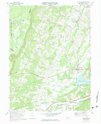
1977 Map of Schellsburg
USGS Topo · Published 1979About this map
Shawnee State Park occupies a central role in this landscape, dominated by the waters of Shawnee Lake and the winding Raystown Branch Juniata River. The map captures the intersection of early Pennsylvania transit and rural community life, marked by two Covered Bridge locations along the river and the Pennsylvania Toll Road carving through the southern terrain. Small settlements like New Paris, Schellsburg, and New Buena Vista serve as anchors for the surrounding townships of Napier, Juniata, and Harrison. Local educational and spiritual centers, such as the New Paris Central Sch and Pleasant View Ch, illustrate the dispersed nature of the mid-century population. Along the eastern edge, the steep rise of Chestnut Ridge creates a natural barrier, while the northern reaches include the protected wilderness of State Game Lands No 228.
Find a feature on this map
40 named features on this map. Tap any name to fly to it.
Don’t see what you’re looking for? This feature index may not catch every label — zoom into the map to look around manually.
Map Details
Editions of this 1977 Schellsburg Map
This is the sole edition of this map. No revisions or reprints were ever made.
Other maps of this area

1908 · Bedford
USGS Topo · 1:62,500

1910 · Bedford
USGS Topo · 1:62,500

1914 · Windber
USGS Topo · 1:62,500

1916 · Windber
USGS Topo · 1:62,500

1923 · Berlin
USGS Topo · 1:48,000

1927 · Hyndman
USGS Topo · 1:62,500

1929 · Berlin
USGS Topo · 1:62,500

1931 · Hyndman
USGS Topo · 1:62,500

1944 · Hyndman
USGS Topo · 1:62,500

1944 · Windber
USGS Topo · 1:62,500