
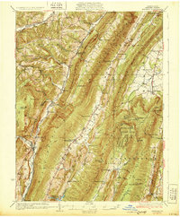
1931 Map of Hyndman
USGS Topo · Published 1931About this map
The ridge-and-valley terrain of Bedford County defines this 1927 survey, where Wills Mountain and Evitts Mountain create sharp corridors for settlement and transit. In the narrow gaps, the town of Hyndman serves as a critical junction for the Pennsylvania RR and the Baltimore and Ohio RR, while small farming communities like Buffalo Mills and Rainsburg occupy the lower basins. The era is marked by a transition from traditional post office hubs, such as Bedford Valley PO, to more modern infrastructure like the Martin Hill Fire Tower and the sprawling State Game Refuge No 20. Numerous country schoolhouses, including Fort Smith Sch and Manassas Sch, are scattered along the rural roads, reflecting a landscape still organized around small, neighborhood-scale institutions. The presence of Seven Dolors Ch and St James Ch further illustrates the localized religious and social centers that anchored these mountain communities before mid-century consolidation.
Find a feature on this map
94 named features on this map. Tap any name to fly to it.
Don’t see what you’re looking for? This feature index may not catch every label — zoom into the map to look around manually.
Map Details
Editions of this 1931 Hyndman Map
3 editions found
Other maps of this area

1898 · Frostburg
USGS Topo · 1:62,500

1898 · Paw Paw
USGS Topo · 1:62,500

1899 · Flintstone
USGS Topo · 1:62,500

1900 · Pawpaw
USGS Topo · 1:62,500

1900 · Flintstone
USGS Topo · 1:62,500

1900 · Everett
USGS Topo · 1:62,500

1901 · Frostburg
USGS Topo · 1:62,500

1902 · Everett
USGS Topo · 1:62,500

1908 · Frostburg
USGS Topo · 1:62,500

1908 · Bedford
USGS Topo · 1:62,500