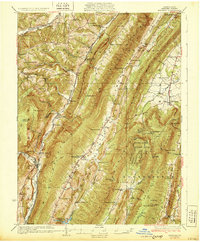
1931 Map of Hyndman
USGS Topo · Published 1931About this map
The Baltimore and Ohio RR and Pennsylvania RR cut through the narrow gap at Hyndman, following the course of Wills Creek in this 1931 survey of Bedford County. The landscape is defined by the rigid northeast-southwest orientation of the Appalachian ridges, including Wills Mountain and Evitts Mountain. Between these heights, small rural communities like Centerville and Buffalo Mills are connected by the Lincoln Highway and early state roads.
Find a feature on this map
93 named features on this map. Tap any name to fly to it.
Don’t see what you’re looking for? This feature index may not catch every label — zoom into the map to look around manually.
Map Details
Editions of this 1931 Hyndman Map
3 editions found

Other maps of this area

1898 · Frostburg
USGS Topo · 1:62,500

1898 · Paw Paw
USGS Topo · 1:62,500

1899 · Flintstone
USGS Topo · 1:62,500

1900 · Pawpaw
USGS Topo · 1:62,500

1900 · Flintstone
USGS Topo · 1:62,500

1900 · Everett
USGS Topo · 1:62,500

1901 · Frostburg
USGS Topo · 1:62,500

1902 · Everett
USGS Topo · 1:62,500

1908 · Frostburg
USGS Topo · 1:62,500

1908 · Bedford
USGS Topo · 1:62,500