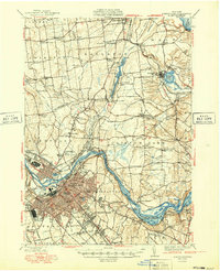
1949 Map of Schenectady
USGS Topo · Published 1949About this map
The Mohawk River serves as the central artery for this late-1940s landscape, illustrating the industrial and educational heart of eastern New York. The city of Schenectady is shown in detail, featuring the campus of Union College, Central Park, and the Nott Terrace High Sch. The map reveals a post-war infrastructure in transition, documenting the path of the Erie Canal (Abandoned) alongside active rail lines like the Delaware and Hudson and West Shore railroads. North of the city, the landscape shifts into a network of small settlements and water bodies, including the resort-dotted shores of Ballston Lake and Round Lake. Notable riverside locations such as Vischer Ferry and Dunsbach Ferry indicate historic crossing points, while the Schenectady County Airport and various gravel pits near Hutchinson point to the era's mid-century economic activities.
Find a feature on this map
87 named features on this map. Tap any name to fly to it.
Don’t see what you’re looking for? This feature index may not catch every label — zoom into the map to look around manually.
Map Details
Editions of this 1949 Schenectady Map
This is the sole edition of this map. No revisions or reprints were ever made.
Other maps of this area

1893 · Cohoes
USGS Topo · 1:62,500

1893 · Troy
USGS Topo · 1:62,500

1893 · Schenectady
USGS Topo · 1:62,500

1893 · Albany
USGS Topo · 1:62,500

1895 · Troy
USGS Topo · 1:62,500

1895 · Cohoes
USGS Topo · 1:62,500

1895 · Albany
USGS Topo · 1:62,500

1895 · Schenectady
USGS Topo · 1:62,500

1895 · Amsterdam
USGS Topo · 1:62,500

1898 · Schenectady
USGS Topo · 1:62,500