2023 Map of Schenevus
USGS Topo · Published 2023About this map
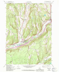
Schenevus and Worcester anchor this corridor of the Charlotte Valley, where the landscape is defined by the steep rises of Badeau Hill and Hooker Mountain. The map details a series of high-elevation hollows and creek basins, including Elk Creek and Sperry Hollow, that have shaped local settlement patterns for generations. Historically significant sites such as Schenevus Cem and Maple Grove Cem are located near the primary transit routes, while smaller clusters like Simpsonville and Smoky Hollow occupy the lower valley floors.
Find a feature on this map
96 named features on this map. Tap any name to fly to it.
Don’t see what you’re looking for? This feature index may not catch every label — zoom into the map to look around manually.
Map Details
Editions of this 2023 Schenevus Map
This is the sole edition of this map. No revisions or reprints were ever made.
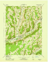
Historical Maps of Schenevus Through Time
3 maps found