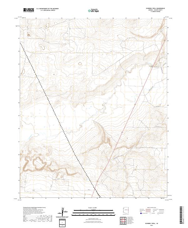
2021 Map of Schnebly Well
USGS Topo · Published 2021About this map
Schnebly Well anchors this high-desert portion of the Colorado Plateau, where the arid landscape is defined by the ephemeral path of the Zuni River. The terrain features distinct topographic rises like Twin Peaks and Mountain Vw, while the built environment is limited to isolated roads and trails. The transition between the high ground and the river valley is marked by the Zuni Wash Bridge, a critical crossing point for local travel. Ranching and land management are implied by the presence of named wells and the grid of township and range boundaries including t16n r28e and t15n r29e. Local routes such as Bonito Valley Rd, Gunsite Way, and Appaloosa Trl trace the contours of the land, providing a record of 21st-century access in this sparsely populated region of the state.
Find a feature on this map
16 named features on this map. Tap any name to fly to it.
Don’t see what you’re looking for? This feature index may not catch every label — zoom into the map to look around manually.
Map Details
Editions of this 2021 Schnebly Well Map
This is the sole edition of this map. No revisions or reprints were ever made.
Other maps of this area

1886 · St Johns
USGS Topo · 1:250,000

1892 · St Johns
USGS Topo · 1:250,000

1954 · Saint Johns
USGS Topo · 1:250,000

1955 · Wolford Springs 3 NW
USGS Topo · 1:24,000

1955 · Wolford Springs 3 SW
USGS Topo · 1:24,000

1957 · Saint Johns
USGS Topo · 1:250,000

1958 · Saint Johns
USGS Topo · 1:250,000

1962 · Saint Johns
USGS Topo · 1:250,000
1974 · St. Johns North
USGS Topo · 1:24,000
1977 · Ceadro Spring
USGS Topo · 1:24,000