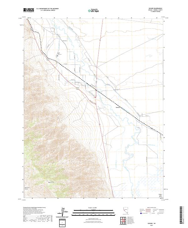
2021 Map of Schurz
USGS Topo · Published 2021About this map
The settlement of Schurz lies at the heart of this Nevada landscape, where the Walker River transitions from the mountainous heights of the Wassuk Range into the broad Walker River Valley. This 2021 survey illustrates a complex water management system essential for life in the Great Basin, featuring Canal Number One, Canal Number Two, and Drain Number One. These man-made channels diverge from the river's path to support local agricultural and community needs.
Find a feature on this map
46 named features on this map. Tap any name to fly to it.
Don’t see what you’re looking for? This feature index may not catch every label — zoom into the map to look around manually.
Map Details
Editions of this 2021 Schurz Map
This is the sole edition of this map. No revisions or reprints were ever made.
Other maps of this area

1908 · Carson Sink
USGS Topo · 1:250,000

1909 · Hawthorne
USGS Topo · 1:250,000

1910 · Carson Sink
USGS Topo · 1:250,000

1911 · Hawthorne
USGS Topo · 1:250,000

1915 · Hawthorne
USGS Topo · 1:250,000

1948 · Walker Lake
USGS Topo · 1:250,000

1951 · Allen Springs
USGS Topo · 1:62,500

1951 · Weber Reservoir
USGS Topo · 1:62,500

1957 · Walker Lake
USGS Topo · 1:250,000

1957 · Reno
USGS Topo · 1:250,000