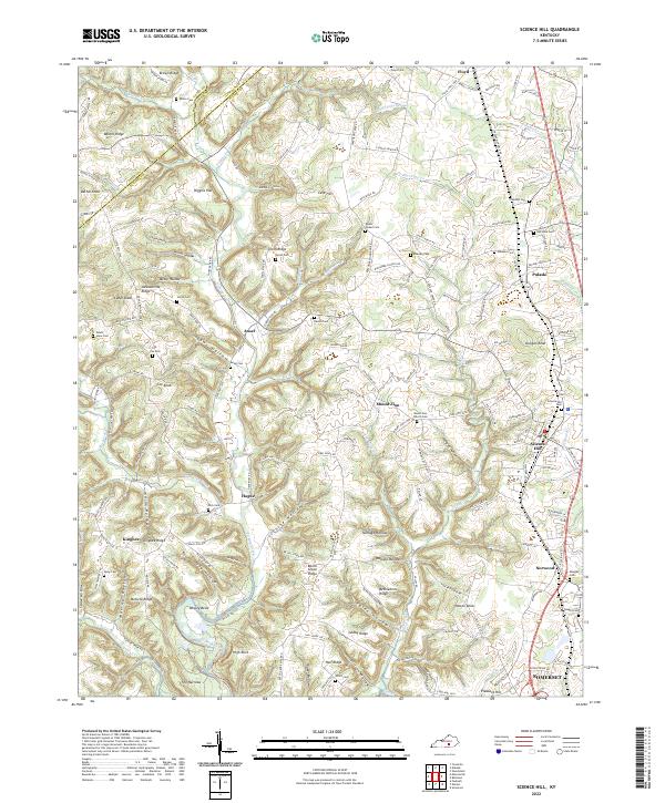
2022 Map of Science Hill
USGS Topo · Published 2022About this map
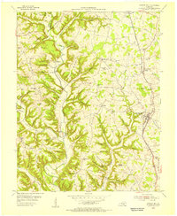
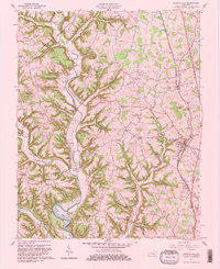
Fishing Creek and its many branches, including Big Clifty Cr and Little Clifty Cr, carve a complex network of ridges and hollows across northern Pulaski County. The landscape is defined by family-named landmarks and high points like Cox Knob and Cedar Knob, reflecting a long history of rural settlement. The Norfolk Southern railroad line provides a north-south transit corridor through the eastern half of the map, linking the communities of Science Hill, Norwood, and Pulaski. These settlements serve as anchors for a dense distribution of small family burial grounds, such as Van Hook Cem and Eubanks Cem, and community spiritual centers like Bethlehem Church. The western reaches, near Hogue and Ansel, remain more secluded, where terrain features like The Narrows and High Rock dominate the local geography.
Find a feature on this map
162 named features on this map. Tap any name to fly to it.
Don’t see what you’re looking for? This feature index may not catch every label — zoom into the map to look around manually.
Map Details
Editions of this 2022 Science Hill Map
This is the sole edition of this map. No revisions or reprints were ever made.
Historical Maps of Pulaski Through Time
3 maps found