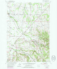
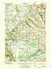
1954 Map of Scotts Mills
USGS Topo · Published 1985About this map
Scotts Mills sits at the base of the rising Missouri Ridge, where the complex drainage of Butte Creek and Abiqua Creek defines the border between Clackamas and Marion counties. This mid-century survey illustrates an established agricultural landscape transitioning from the open levels of Elliott Prairie in the northwest to the more varied terrain of the southern foothills. The map documents a dense network of local civic life through rural schools such as the McLaughlin School and the Butte Creek School, alongside historical burial grounds like Maplewood Cem and Miller Cem. Smaller communities such as Monitor and Marquam anchor the road system, while localized industry is evidenced by a Quarry and several small reservoirs. The presence of the Trinity Lutheran Ch and the Grange Hall near Oaklawn suggests a community structure built around shared labor and faith during the postwar era.
Find a feature on this map
36 named features on this map. Tap any name to fly to it.
Don’t see what you’re looking for? This feature index may not catch every label — zoom into the map to look around manually.
Map Details
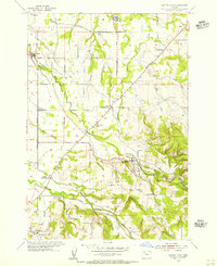
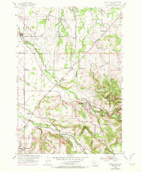
Editions of this 1954 Scotts Mills Map
3 editions found
Other maps of this area

1923 · Mount Angel
USGS Topo · 1:62,500

1925 · Stayton
USGS Topo · 1:62,500

1939 · Molalla
USGS Topo · 1:62,500
1940 · Molalla
USGS Topo · 1:62,500

1940 · Mount Angel
USGS Topo · 1:62,500
1941 · Stayton
USGS Topo · 1:62,500

1948 · Vancouver
USGS Topo · 1:250,000

1950 · Vancouver
USGS Topo · 1:250,000

1950 · Vancouver
USGS Topo · 1:250,000
1951 · Lyons
USGS Topo · 1:62,500