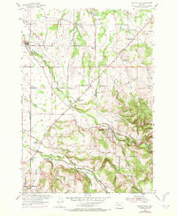
1954 Map of Scotts Mills
USGS Topo · Published 1971About this map
Scotts Mills sits at the base of the rising Missouri Ridge, where the agricultural flats of the Willamette Valley meet the more complex elevations of the foothills. This 1954 survey, updated with 1970 revisions, documents a landscape shaped by timber and tillage, evidenced by the presence of a Sawmill and multiple quarries. The boundary between Clackamas and Marion counties follows Butte Creek, a waterway that anchors several small rural communities including Monitor and Marquam.
Find a feature on this map
37 named features on this map. Tap any name to fly to it.
Don’t see what you’re looking for? This feature index may not catch every label — zoom into the map to look around manually.
Map Details
Editions of this 1954 Scotts Mills Map
3 editions found
Other maps of this area

1923 · Mount Angel
USGS Topo · 1:62,500

1925 · Stayton
USGS Topo · 1:62,500

1939 · Molalla
USGS Topo · 1:62,500

1940 · Molalla
USGS Topo · 1:62,500

1940 · Mount Angel
USGS Topo · 1:62,500

1941 · Stayton
USGS Topo · 1:62,500

1948 · Vancouver
USGS Topo · 1:250,000

1950 · Vancouver
USGS Topo · 1:250,000

1950 · Vancouver
USGS Topo · 1:250,000

1951 · Lyons
USGS Topo · 1:62,500